Thank you for your patience while we retrieve your images.


Thumbnails
Info
Categories & Keywords

Category:
Subcategory:
Subcategory Detail:
Keywords:B, Bentonite, Bentonite Hills, Blue Hills, CRNP, Capitol Reef National Park, Cathedral Valley, Connecticut, Landscape, MDRS, Mars, Mars Desert Research Station, North America, SDC GEOGRAPHIC / LOCATION, United States, Utah, aerial, atuomobile, auto, badlands, banded hills, birds eye view, car, color, colorful, desset, drone, formations, hill, hills, jeep Wrangler, land, mars research stations, national, natural, nature, park, peaks, southern, soutwest, stairs, sub, trails, transportaion, upper, vehicle, view
Photo Info

Dimensions5272 x 3948
Original file size14.3 MB
Image typeJPEG
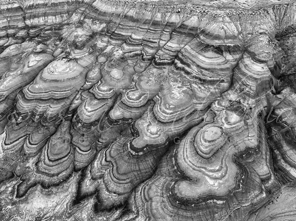
Utah Badlands Aerial  BW

Utah Badlands Aerial BW

Utah Badlands Aerial - Drone View of the colorful patterns seen at the Bentonite Hills in the southern Utah Badlands.

The Bentonite Hills appear as softly contoured, banded hills in varying hues of brown, red, purple, gray, and green.

The hills are composed of the Brushy Basin shale member of the Morrison Formation. This layer was formed during Jurassic times when mud, silt, fine sand, and volcanic ash were deposited in swamps and lakes.

This image is available in color as well as black and white.

To view additional images or photographs from this or any other of my collections please visit www.susancandelario.com

Thank You!